They are among the future entrepreneurs and innovators in the UK’s multi-billion pound space industry.
Ten space-related innovation projects have been selected from nearly 70 expressions of interest to receive a comprehensive package of incubation support worth more than £12,000 to each project over the next six months.
The aim of the OI Space Incubator programme, supported by the UK Space Agency, is to turn ideas quickly into a commercial offering within the fields of satellite communications, navigation and earth observation.
Eighteen shortlisted projects wanting to get on the new programme were stress-tested over two days at Fareham Innovation Centre in south Hampshire.
Workshop challenges included technology feasibility, commercial viability and market-positioning tests to help cohort hopefuls pitch their projects to 20 judges from partner organisations.
Speed mentoring and networking with judges completed the process of evaluation and feedback.
High-profile mentors included Adrian Braine, a business innovation leader in connectivity from SETsquared, Tim Doidge, who has helped hundreds of start-ups pitch more effectively to investors at major showcases, and Vincenzo Roberti, a serial entrepreneur who has created and built technology companies and brands.
Various projects sprung on to the drawing board in response to an innovation challenge set by Ordnance Survey, Britain’s national mapping agency.
Interest in the programme came from as far as Nottinghamshire, then Dorset, Wiltshire, Surrey and Hampshire.
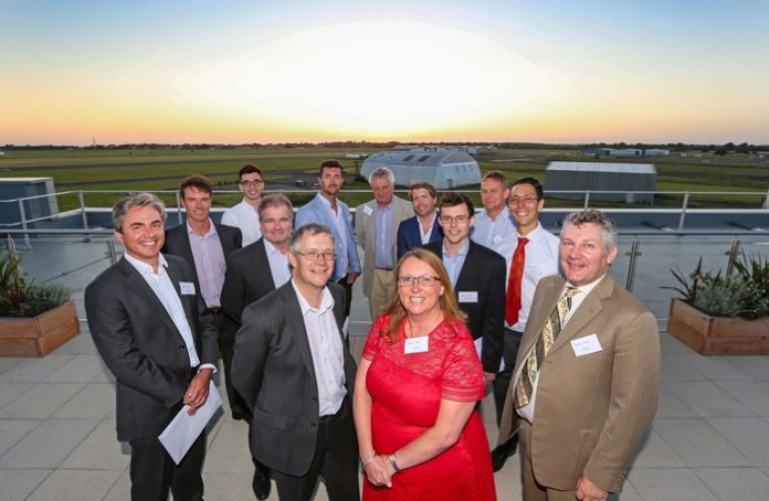
More than 100 participants and guests rounded off the event with a gala dinner and presentations at The Bridge, the new top-floor, high-tech conference centre at Fareham Innovation Centre and overlooking Solent Airport.
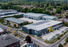
The newly-enlarged centre is home to 40-plus companies in the aerospace, marine and engineering sectors.
Managed by Oxford Innovation the state-of-the-art facility has a total of 57 offices, 20 workshops, meeting rooms and the conference centre.
Oxford Innovation (OI) was recently awarded funding by the UK Space Agency to run a space business incubator at Fareham and its sister centre BASE Bordon Innovation Centre in East Hampshire, near a rich space-related talent pool.
Richard May, the OI Space Incubator programme manager, said afterwards: “The two days have been a fantastic success; we are confident that the selected 10 projects have the potential to be next-generation businesses in Great Britain’s multi-billion pound space industry.”
He added: “The cohort have identified valuable downstream space applications that can become start-up businesses or new geo-tech extensions to existing offerings within the six months.
“The programme helps us grow a space sector cluster in both Fareham and Bordon alongside the aviation, marine, logistics, agri-tech, big-data, smart city and gaming businesses we already support in Hampshire.
“They will receive free workspace, two interns, 24 purpose-design incubation and business acumen workshops, expert R&D advice and test facilities from prime partners and match-making with non-executive directors and investors.”
Keynote speaker Richard Peckham provided a general overview of the UK space industry; a great context to the space incubator.
Richard is a director at Alden Adviser, having recently left Airbus where he was Strategy and Business Development Director for the space activities of Airbus in the UK.
Richard, former Chairman of UKspace, the space trade association, is also co-chair of the Satellite Finance Network (SFN) which was set up to connect investors with space entrepreneurs.
In the welcoming address at the gala dinner, Joanne Willett, Oxford Innovation’s Managing Director, thanked the UK Space Agency for its support, as well as the South Coast Centre of Excellence in Satellite Applications for sponsoring the gala dinner.
Helen Roberts, Programme Manager for UK Space Agency, presented certificates to the business founders with selected projects.
She said afterwards: “The UK space sector is growing, worth £13.7 billion to the economy and employing more than 38,000 people across the country, but this growth wouldn’t be possible without initiatives like the OI Space Incubator Programme which provides vital support to the pioneers of the future.
“The UK Space Agency is delighted to see this cohort of entrepreneurs joining the programme, which is part of the UK Space Agency’s Business Incubation network.
“We look forward to seeing their businesses grow and contribute to our ambition of capturing 10% of the global space market by 2030, a key part of the Government’s Industrial Strategy.”
Ann Cooper, Head of Careers and Employability at the University of Southampton, then presented certificates to 11 interns that will work for 10 weeks during the summer to give the incubator cohort initial technical expertise and a resource boost to design and develop solution prototypes.
Named interns are Ali Hamza, Maria Angelova, Hiba Azim, Carl Booth, Lucy Emery, Hans Gunnoo, George Marsden, Mateusz Marton, Charlie North, Karan Sharma and Peter Wattle.
The judges and remaining gala dinner guests include key executives and space sector experts from Ordnance Survey, Airbus, BAE Systems, Autonomous Surface Vessels, Earth-i, In-Space Missions, Granttree, Lumico, Fareham College and the nine universities of Southampton, Solent, Portsmouth, Winchester, Surrey, Leicester, Durham, Nottingham and Loughborough.
Richard added: “One of the main benefits for the cohort is the expert advice and introductions given by these partners to the OI Space programme.
“The partners are offering free workshops, access to raw space data, tools, and test facilities – what more do you need!”
The top 10 projects
Stephen Smith of Chemical Design – navigation – an app to track the speed and position of skydivers so data can be shared on social media.
Sebastian Holmes of Agritherm – satellite communications/navigation/Earth observation – response to Ordnance Survey challenge – using satellite communications, navigation and earth observation to predict lameness in dairy cows.
Russ Cole of ESL Group – satellite communications/navigation/Earth observation – response to Ordnance Survey challenge – using drones and Ordnance Survey geo data for crisis management situations, with secure data transmitted to Internet of Things-connected devices for evaluation and action.
Matthew Fancourt and Zach Ross-Clyne of KOIOS Master Data – general innovation – an app for field engineers involved in maintenance operations, such as at factories, so they can capture data to better guide on servicing and replacement parts; avoids costs and delays caused by incorrect spares ordering.
Michael Castle of Pinpoint Satellite Navigation – navigation – response to Ordnance Survey challenge – development of farm robots to apply correct volume of fertilisers, reducing costly wastage and pollution.
Gareth Evans of Constructex – navigation – response to Ordnance Survey challenge – adopting Android devices with software for precise remote surveys by drones and remote operated vehicles.
Stephen Crawford of CB Media Group – satellite communications/navigation/other – response to Ordnance Survey challenge – utilising satellite technology to develop an app where yacht crews across the world can tag themselves, with social messaging applications.
Paul Dawson of Psion Consulting – satellite communications/navigation/other – GPS-enabled smart eyewear to allow hands-free inspection of complex engineering structures in challenging environments. Would allow users to identify, locate, analyse and record the condition of assets.
Andrew Burrows of Aerohydro Consulting – navigation/other – CloudBox is a connected flight recorder which combines GPS and magnetometer data to create a ‘black box’ that automatically captures and logs all flights, engine and aircraft configuration data. The data is uploaded for online post-flight diagnostics to improve aircraft and pilot safety.
Alex Barter of Barter For Things – general innovation – using an Internet of Things network commissioned by Southampton City Council, collecting pothole data from fleet vehicles. They are fitted with shock/global navigation satellite system devices which transmit location data. The project focuses on machine-learning techniques to increase accuracy of pothole detection.

