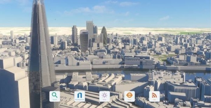
VUCITY is debuting its fully interactive 3D digital model of London which covers more than 100km sq in unprecedented level of detail and accuracy.
Launching in the Innovation Forum, with two interactive touch tables and a giant video wall, VUCITY offers developers, planners, architects, transport engineers and those involved in city planning the ability to plan, propose and visualise cities in a way not available until now.
The ability to overlay data in the interactive model is critical to city planning. Users can overlay and review existing, consented and proposed developments. There is also the ability to overlay data such as sunlight paths, real time transport overlays, demographics and pedestrian modelling.
Jason Hawthorne, MD of Wagstaffs says: “VUCITY provides an element of future proofing within the urban environment. It is transforming the planning process by visualising the development of the city landscape and enabling decision makers to interact with the city model and turn on and off proposed developments as well as overlaying insightful data. This way VUCITY can help inform the debate around many of the planning issues and will help those involved to make the best decisions.”
“The quality and the level of detail of the underlying 3D Model combined with the interactive functionalities meant that VUCITY has generated serious attention from developers, planners and London boroughs even in its pre-launch stage”, adds Michal Konicek, Manager of Vertex Modelling.
“Its success has encouraged us to bring forward our plans and ambition to model more of the world’s major cities in the same level of detail and accuracy – we are currently capturing Paris and New York and just like in London, we are aiming for the same accuracy of 15cm across these models.”
The latest features of VUCITY include:
• A complete model of central London, with Paris and New York models under construction
• Add existing, proposed and consented developments
• Add accurate street level camera points to create verified views
• London View Management Framework protected views
• Daylight and sunlight studies
• Integrate data; demographics, traffic and pedestrian modelling
• Custom live data; transport, property, news, Twitter, weather, environment
• Real time transport overlays


